What it is
What El Niño is, and what the official index is now
Three official ways to last 0.5 °C, and a Public Information Statement that changed the monitoring index.
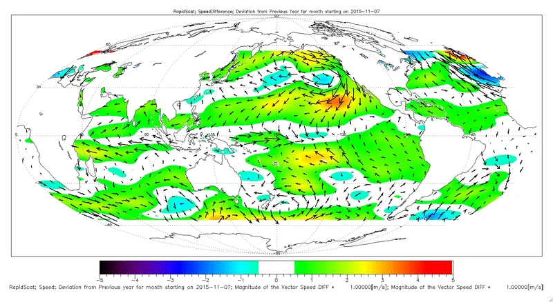
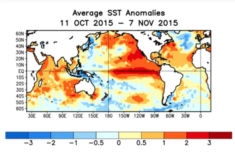
The Met Office describes El Niño as anomalous sustained warming, typically of the central-east equatorial Pacific; La Niña as cooler-than-normal sea-surface temperatures; ENSO as the El Niño Southern Oscillation; and the Southern Oscillation as atmospheric pressure changes between the east and west tropical Pacific. [source] The Niño3.4 region is given as 5°S–5°N, 120°W–170°W.
How long a departure has to last
Definitions vary, and this desk keeps them unblended. CPC’s FAQ says CPC declares the onset of an El Niño episode when the 3-month average sea-surface temperature departure exceeds 0.5 °C in the east-central equatorial Pacific, between 5°N–5°S and 170°W–120°W. [source] The Met Office, “as a guide,” says episodes occur when anomalies in this region are larger than about 0.5 °C in magnitude for several months. [source] A typical episode lasts three or four seasons, peaking in boreal winter; it is not entirely regular, and events can occur successively. [source]
ONI, and the switch to RONI
The Oceanic Niño Index v6 page still documents the historical rule: a threshold of ±0.5 °C, in a 3-month running mean of ERSST.v6 SST anomalies in Niño 3.4 (5°N–5°S, 120°–170°W), for a minimum of five consecutive overlapping seasons. Most recent ONI values are estimates and may change up to two months. [source] The same page says that, per NWS Public Information Statement 26-05, the Relative Oceanic Niño Index (RONI) is used for official monitoring and prediction. The ONI page will continue to be updated, but it is no longer the official monitoring index.

The official RONI outlook, issued November 2026, uses a 1991–2020 base period, and notes that large positive or negative values of RONI do not necessarily correspond with the strength of the influence or expected impacts. [source] CPC’s FAQ, separately, has said La Niña occurs every 3 to 5 years or so. [source] Climate.gov pages opened on 18 November 2026 were an archived snapshot as of 25 June 2025, still showing an April 2025 Final La Niña Advisory. That archive is not used as current status; it is noted in the field notes only.
Enjoyed a dated official advisory, unblended thresholds, and a careful look at chances rather than guarantees?
No pop-ups. No intrusive advertising. Just interesting stuff. A little support helps the next climates.im site get built.